Iowa Civil War Monuments
Cerro Gordo County
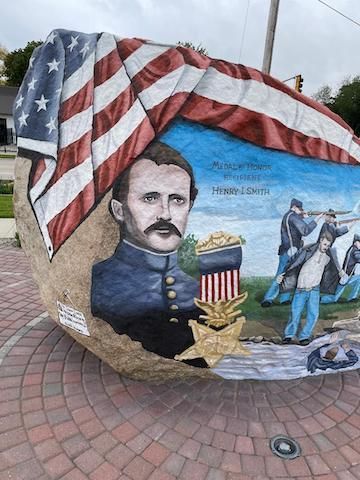
Clear Lake - Cerro Gordo County Freedom Rock - GPS Coordinates: 43.140300 by -93.207200
Captain Smith (1840-1910) of the 7th Iowa Infantry, was awarded the Medal of Honor for rescuing a soldier who was swept by the current down the Black River in North Carolina on March 15, 1865. This was done in enemy territory at great risk to Capt. Smith. He was born in England and his family moved to a farm in Cerro Gordo County in 1854. After the war, he returned to farming, then became County Treasurer and later entered the banking business. He is buried in the Elmwood-St. Josephs Cemetery on the south side of Mason City. It is on the west side of Highway 65. He is buried in "Block 2 Original" on the west side of the cemetery. These photos were taken 3/27/09.
In the Fall of 2018, the Cerro Gordo County Freedom Rock was completed. It was painted by Ray "Bubba" Sorensen and honors Captain Smith. It is located at Main Avenue and 8th Street in Clear Lake. Thanks to Walt Busch for notification and sending photos in October, 2021.


Clear Lake - Lincoln Statue - GPS Coordinates: 43.142616 by -93.366883
This is a very impressive Lincoln statue in the Clear Lake cemetery. It is 22 feet high with a polished red granite base. It was dedicated to "The Defenders of the Union" on Memorial Day, 1918. It was rededicated by the SUVCW in 2003. There are inscriptions of various battles on the four sides of the monument. There is also another Civil War monument back of the Lincoln statue. These are located on the east side of town near I-35. The cemetery is on 7th Avenue N just south of Highway 18 (the main road from I-35 into town.) The statue is in the NW part of the cemetery. Photos taken 6/17/20.


Clear Lake - Plaque on Boulder - GPS Coordinates: 43.135600 by -93.384000
This is located in the downtown park by the lake. The monument is on the side of the park facing the lake. There are information displays on three sides with a focus on local Company B of the 32nd Iowa Infantry Regiment. It participated in battles at Pleasant Hill and the Red River Campaign. There is also mention of the Tom Howard GAR Post No. 101. Howard was killed at Pleasant Hill. Note the 4 holes above the plaque - Kevin Pearson pointed out that an old photo shows an eagle attached to the stone. We presume that this was stolen or vandalized in the past. The first photo was taken 6/17/20 - the close up on 8/2/09.


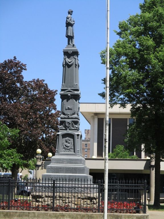
Mason City - Civil War Soldier and Plaque GPS Coordinates: 43.152233 by -93.201450
This monument in the Central Park in Mason City is 30 feet high and of white bronze or zinc. It is impressive with very intricate design elements. Soldiers from the area that gave their lives are shown on the four sides of the monument - the ones on the east side are shown below. There is also a plaque and the GAR emblem on a boulder nearby. It indicates that it was dedicated by the SUVCW and DUVCW on May 30, 1929. The park is in the downtown area of Mason City on N Federal Avenue. Photos taken 6/17/20 - the photo of the plaque and GAR emblem was taken 3/14/08. Also shown is an old photo dated 9/17/42 of a Civil War Rodman cannon being removed for scrap during WWII.


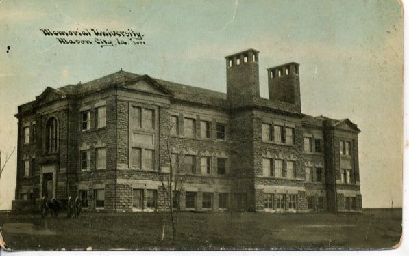
Mason City - Memorial University Plaque - GPS Coordinates: 43.136389 by -93.198056
The SUVCW operated Memorial University in Mason City from 1902 until 1910. The building was then used by the school district until torn down in 1979. Today, the school district administration building is on this site. A plaque was dedicated here on January 24, 2015 with information about the history of Memorial University. Credit goes to SUVCW member Jim Wolf and the Huntley Camp in Mason City for their efforts to obtain funds for the plaque. It is interesting that the SUVCW has developed an educational program for members using the Memorial University name. SUVCW members attending the dedication were, left to right, Ken Lindblom, Kevin Pearson, David Thompson, Jim Wolf, Danny Krock, and Dennis Sasse. Thank you to Denise Sasse for this photo. Also, thank you to Danny Krock for furnishing the old postcards of the University. The location of the building is 1515 South Pennsylvania in Mason City.


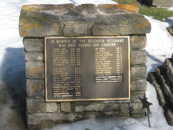
Rock Falls - Plaque to Fallen Soldiers - GPS Coordinates: 43.212150 by -93.086200
This plaque includes soldiers from Rock Falls from all wars. Rock Falls Cemetery is NW of town on the north end of Market Street. At the entrance, look to the right by the flagpole to find the monument. Photo taken 3/14/08.
