Iowa Civil War Monuments
Cherokee County
Cherokee - Civil War Monument - GPS Coordinates: 42.748716 by -95.575583
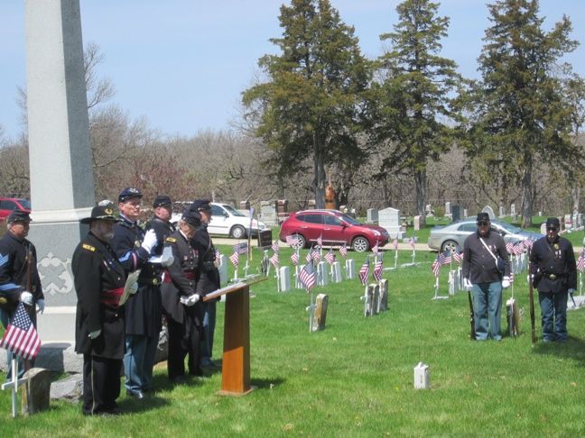
This is a 18 foot obelisk in Oak Hill Cemetery. It is in the Civil War section in the SE part of the cemetery. The inscription says "Erected by the Custer Post No 25 Department of Iowa GAR in memory of our Comrades." It is located west of town. Follow Main Street west to the cemetery which is about 1/2 mile out of town. The first two photos were taken 9/22/21. The third photo was taken 5/4/14 at a monument re-dedication ceremony led by members of the SUVCW Kinsman Camp.


Cherokee - Plaque near site of Fort Cherokee - GPS Coordinates: 42.760533 by -95.534850
Due to the "Great Sioux Uprising of 1862" a number of forts were built to protect settlers in NW Iowa. The Northern Border Brigade was organized and served in this region. It kept soldiers tied up in this area who could not go south to fight the Confederates. Besides Cherokee, see other monuments listed for Peterson, Spirit Lake, Estherville and Fort Dodge. This marker may not be completely accurate as the fort was 200 feet west and it was built by the Northern Border Brigade. The bronze plaque, set on a granite base, is on private property at the SW corner of Riverview Drive and Colony Drive. Photos taken 9/22/21.

