
Iowa Civil War Monuments
Polk County
Des Moines - Camp Burnside Marker GPS Coordinates: 41.591566 by -93.587416
This plaque marks the spot of Camp Burnside where the Iowa 23rd and 39th Regiments were assembled and trained in 1862. It is located in the SE corner of Redhead Park at E 18th and Dean on the east side of Des Moines. It was dedicated in 1925 by the SUVCW Dodge Camp Auxiliary. In 2016 attractive landscaping was planted in front of the Monument. The first photo was taken 4/30/09 - the second one 9/17/16.


Des Moines - Courthouse Plaque GPS Coordinates: 41.584333 by -93.623083
On the SE corner of the Polk County Courthouse is a plaque on a boulder honoring Civil War soldiers from the county who enlisted in 1861. The monument was dedicated in 1926. The Courthouse is on the corner of Court Avenue and 5th Street. Photos taken 11/20/07.


Des Moines - General Marcellus Crocker Bridge GPS Coordinates: 41.627500 by -93.645000
Highway 6 runs coast-to-coast and is named the Grand Army of the Republic Highway. Iowa has also named bridges on the Highway after Iowa CW Generals. There are 11 of these across the state. This one is on the Euclid Avenue Bridge in Des Moines and is named after General Marcellus M. Crocker. There are 29 highway markers - an example is listed under Oakland in Pottawattamie County. Crocker was the Colonel of the 13th Iowa and later was promoted to head the famous "Crocker's Iowa Brigade". He had divison commands during the Atlanta Campaign. He died of tuburculosis August 26, 1865. Also look under Civil War Generals in Woodland Cemetery in Des Moines for more information. Photo taken 8/28/10.

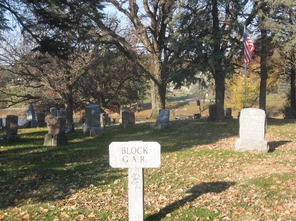
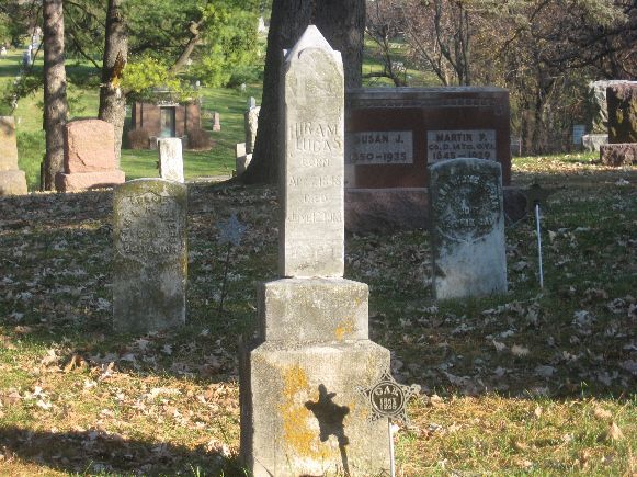
Des Moines - Glendale Cemetery - GAR Section GPS Coordinates: 41.601133 by -93.685566
There is a very nice GAR section at the entrance to Glendale Cemetery. While there is no monument, this is worth a stop to see a good number of CW veterans buried here. The cemetery also contains two CW cannons and the tombstone of Medal of Honor recipient William Campbell (at another location in cemetery). At the entrance near 48th and University, this section is on the left after passing markers for WWI veterans. Photos taken 11/4/08.
Des Moines - State Capitol Building - Civil War Plaques GPS Coordinates: 41.591300 by -93.603810
Around the Rotunda of the Iowa State Capital are two plaques. One is General John Logan's Memorial Day Order of 1868. The other is Abraham Lincoln's Gettysburg Address. Also shown is a display case with a rotating battle flag from an Iowa Regiment. The one shown in the photo is from the 2nd Iowa Cavalry. The Memorial Day Order is on the NW corner of the Rotunda, the Gettysburg Address is on the SE corner, and the flag display case is on the NE corner. The photos were taken 4/22/17.


Des Moines - State Capitol Building - Ceiling - GAR Medal GPS Coordinates: 41.591300 by -93.603810
To commemorate the 56th National Encampment in 1922, a GAR Medal was painted on a banner and stretched across the ceiling of the Iowa State Capital. The painting was on canvas and held up with piano wire. It was painted by Joseph Czizek. The banner and background were restored and repainted in 1998. This is a spectacular view with the medal on a background of blue sky and clouds 275 feet high. These photos were taken 5/28/08 and 12/17/11.


Des Moines - State Capitol Grounds - Crocker GAR Post Monument GPS Coordinates: 41.590083 by -93.602300
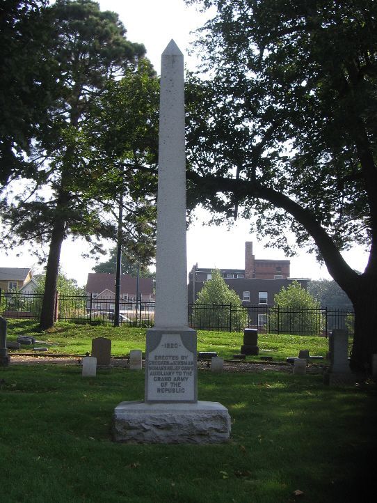
This granite monument is on the State Capital grounds, located on Locust Street east of the Soldiers and Sailors Monument. It was erected in 1944 by the Crocker Womans Relief Corps to honor the Crocker GAR Post. This was named after General Marcellus M. Crocker. Photo taken 9/25/07.

Des Moines - State Capitol Grounds - GAR Flagpole GPS Coordinates: 41.587583 by -93.600833
This 65 foot flagpole was dedicated to the GAR by the Ladies of the GAR at their 1931 national convention. The base has three sides - the panels are tarnished and need restoration. The flag is flown only on holidays. This is located in a very nice wooded area behind the Judicial Building off Court Avenue on the Capital Grounds. It is on high ground and the flag is visible over a wide area when flown. Photo of flag taken on Memorial Day, 2008; other photos taken 10/17/16.
The bench is near the flagpole and was donated by the Ladies of the GAR in 1938. The inscription reads "Dedicated in sacred memory of the Grand Army of the Republic by the National Body Ladies of the Grand Army." The photo taken 9/21/07.


Des Moines - State Capitol Grounds - GAR Sundial GPS Coordinates: 41.590983 by -93.604833
This bronze sundial was dedicated to Union veterans during the 1938 National Encampment in Des Moines. 100 of an estimated 5000 living veterans attended this encampment. The sundial is located west of the State Capital and is said to keep perfect time. The first photo was taken 9/25/07. The close-up photo was taken 10/17/16.


Des Moines - State Capitol Grounds - Soldiers and Sailors Monument GPS Coordinates: 41.589733 by -93.603466
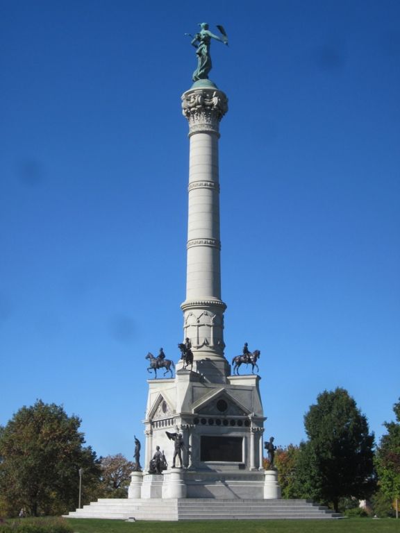
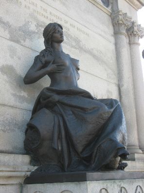
This large impressive monument is located on the State Capital grounds south of the Capital Building. The 135 foot monument was started in 1894 and completed two years later. Harriet Ketcham of Iowa won a competition and was selected as the designer. She died before the project began and sculptor Carl Rohl-Smith, a native of Denmark, was retained to complete the monument. Extensive restoration took place during the 1990’s. The base includes equestrian statues of Generals Crocker, Corse, Curtis, and Dodge. There are also statues representing the infantry, cavalry, artillery and navy. Round portrait sculptures represent many Iowans prominent in the War. There are also two bas-relief scuptures - one representing Iowa at Ft. Donelson and the other titled "Homecoming" which is shown below.
The first photo shows the entire monument from the SE with the "Victory" statue atop the monument. The photo of the base is from the SW and shows three of the Generals, the artillery, cavalry and sailor statues and the Woman with Child. Lt. James Horton represents the cavalry in the close-up photo. The nude woman is on the north side and has been controversial - it is said to be an allegorial figure of Iowa representing our state as a beautiful, youthful mother offering nourishment to her children. Also shown is one of the bas-relief sculptures and a plaque to the sculptor and designer. Photos taken 9/21/07 and 11/18/08. The final photo commemorates the 150th Anniversary of the end of the War on April 9, 2015, with Governor Terry Branstad laying a wreath and reading a proclamation regarding the end of the War.




Des Moines - Union Park Plaque GPS Coordinates: 41.610050 by -93.607216
This plaque says, "This tree dedicated as a living memorial of the 150th anniversary of the formation of the United States Constitution by the National Womans Relief Corps Auxiliary to the Grand Army of the Republic Des Moines, Iowa September 4, 1938." The plaque is hard to find. It is under the branch of the large pine tree that was planted there in the center of the photo. The base stone has settled and the plaque is difficult to read. It is in the SE corner of Union Park at E 9th Street and Jefferson Street. Photo taken 4/15/08.

Des Moines - Woodland Cemetery - Army Nurses GPS Coordinates: 41.589233 by -93.648850
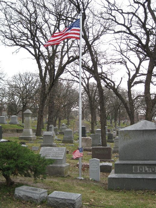
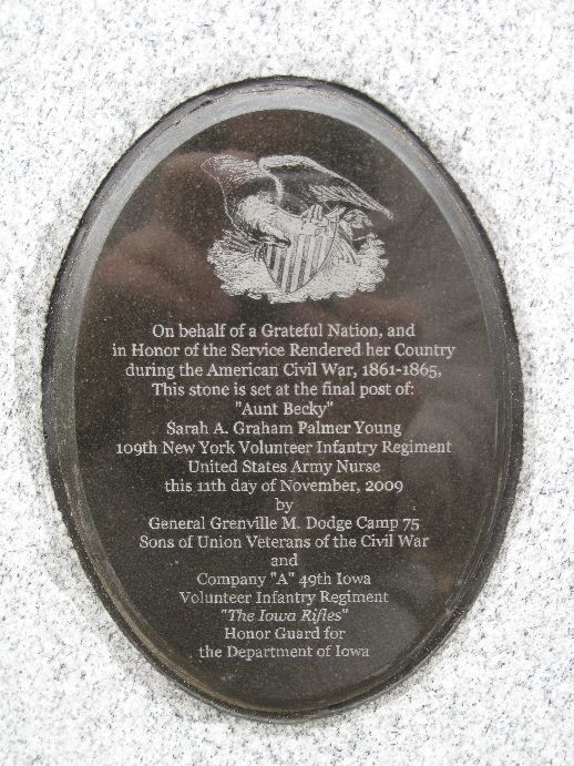
Sarah "Aunt Becky" Young (1830-1908) followed her home regiment at Ithaca, NY (NY 109th Infantry Regiment) in 1862 and was assigned as a Volunteer Army Nurse in field hospitals. She served continually through the end of the war. It was said that she was "beloved and famous throughout the Union Army." President Lincoln toured her hospital on April 7, 1865, just a week before he was assassinated. She married David Young after the war and they moved to Des Moines. She was active in the WRC and Veteran affairs and known everywhere as "Aunt Becky." She was author of a book, "The Story of Aunt Becky's Army-Life" by Sarah A. Palmer, published in 1867. All but 3 months of her diary was lost so the book includes her account of her experiences plus the existing portion of the diary from February-April of 1865. While she is modest in listing her accomplishments, the book is interesting and provides an excellent account of the often dreadful conditions in the army field hospitals. She is buried in Woodland Cemetery in Des Moines near the city vault and flagpole in the SW area of the cemetery. Due to efforts of the SUVCW Grenville M. Dodge Camp #75, a veteran's headstone was obtained and a plaque placed on the back of the headstone. A large crowd gathered on November 11, 2009 to rededicate this memorial in her honor. There is a photo of a flag being presented by 1st Sgt. David Lamb to Fred Pease, a descendent of Aunt Becky.
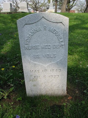
There was another dedication for an Army Nurse, Rosanna Rush Merrill (1843-1923) on May 7, 2021. The gravesite was in a previously unmarked location in Woodland Cemetery. Many organizations were represented at the dedication, including the Nurses Honor Guard, the Sons of the American Revolution Honor Guard and the Iowa National Guard Funeral Honors Team. The later group performed a flag folding ceremony and presented the flag to relatives of Ms. Merrill. A photo of this is shown below. Also shown is a photo of the SAR and Nurses Honor Guards and a copy of the obituary with more details of her life. The location of the gravesite is in Block 14 behind the larger Boylen stone - about 75 yards east of the flagpole by Aunt Becky's headstone. Mike Rowley - shown below in Rev War uniform - organized the Merrill dedication and also has led an effort to obtain headstones from the V.A. for veterans in unmarked graves. He has been responsible for over 200 of these from 2020 through mid-2022. He has found many of these in Woodland Cemetery for CW veterans. Ms. Merrill was one of these in a previously unmarked grave.





Des Moines - Woodland Cemetery - General Nathaniel Baker Monument and Cannons GPS Coordinates: 41.590366 by -93.649316
General Baker served as Iowa’s Adjutant General during and after the Civil War. He had a major role in raising 57 regiments during the war. He was considered a friend and supporter of veterans after the war. When he died in 1876, veterans raised funds for an impressive monument in Woodland cemetery. The location is in the western portion of the cemetery. This granite obelisk is about 25 feet high. The monument photos were taken 9/21/07.
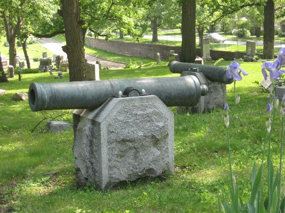
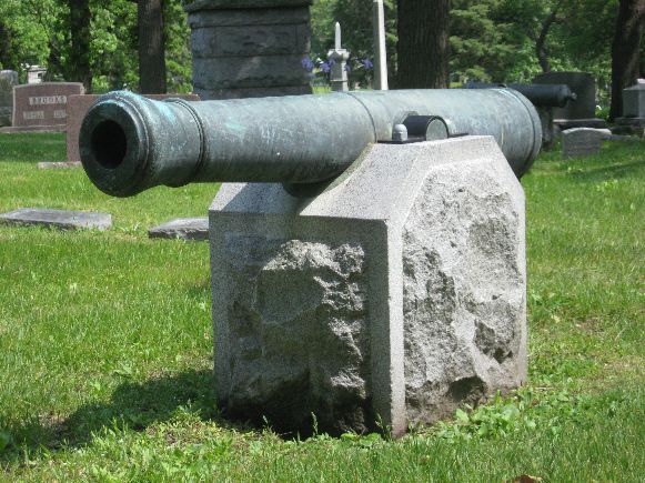
Originally there were four cannons surrounding the Baker Monument. One of these has been loaned to the Gold Star Museum, a military museum, at Camp Dodge in Johnston, Iowa. The one at the Museum and the two in first photo are 12 pounder Confederate bronze howitzers cast at Quinby & Robinson of Memphis. The last one shown is a 6 pounder bronze field gun, M1841 from Cyrus Alger & Co. in 1854. The cannon photos were taken 5/25/08.



Des Moines - Woodland Cemetery - Civil War Generals GPS Coordinates: 41.588883 by -93.646783
This is a small granite monument in the south GAR section of Woodland Cemetery in Des Moines, Iowa. It honors four Iowa generals buried in the cemetery. On the back is an inscription indicating the monument was dedicated by students of the Clive Elementary School in 1994-1995.
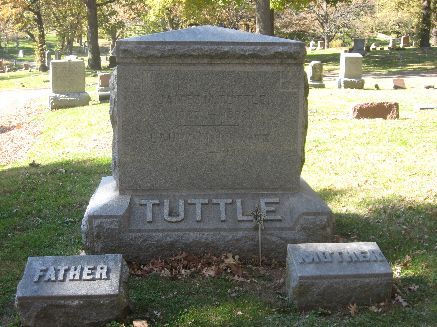
Also shown are the gravestones for Generals Tuttle, Merrrill and Crocker. The large memorial for General Baker is shown as a separate monument. General James Tuttle's tombstone is in block 6 about 50 yards west of the Hoyt Sherman mausoleum. General Merrill's tomb is built into the side of a hill. It had been in poor condition and was restored in 2016. It is in block 14. The plaque shows that he was Governor from 1868-72. General Crocker's original memorial - see newspaper photo - had deteriorated and was replaced with a more modern marker about 1990. It is more difficult to find - it is in block 6 about 50 yards north of the Hoyt Sherman mausoleum. Photos were taken 10/31/08 - the photo of Merrill was taken 10/19/16.
There is also a 5th General with a brevet rank that could have been included. General James B. Weaver is buried in Block 23 - Lot 52 located near the west edge of the cemetery. These photos, taken 7/27/09, are included below. See his home and a plaque in Davis County which are listed as a separate monument. There is also more information about him. The GPS coordinates for this monument in Woodland Cemetery are 41 35.368 -93 38.964



Des Moines - Woodland Cemetery - Civil War Veterans GPS Coordinates: 41.588916 by -93.646766
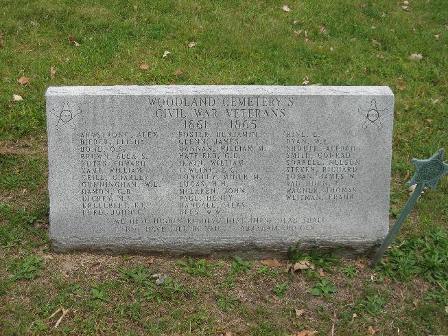
There were a number of soldiers buried at Woodland that were not marked. This granite monument includes 34 of these soldiers. It was dedicated in the mid-1990's. Through the effort of SUVCW member Mike Rowley, most, if not all, now have a Veterans headstone. It is located in the south GAR section of the cemetery. The first photo was taken 9/24/07. The second photo was taken at a wreath laying ceremony on Veterans Day 11/11/12. The final three photos show the names in more detail and were taken 9/17/16.


Des Moines - Woodland Cemetery - Flower Girl Monument GPS Coordinates: 41.590000 by -93.645333
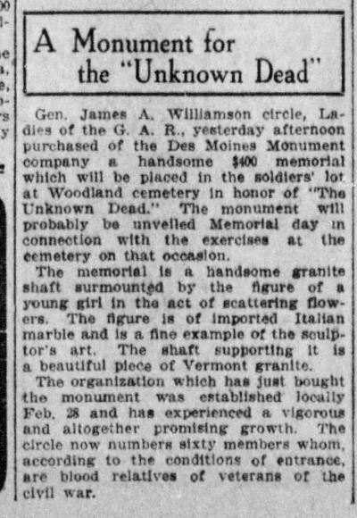
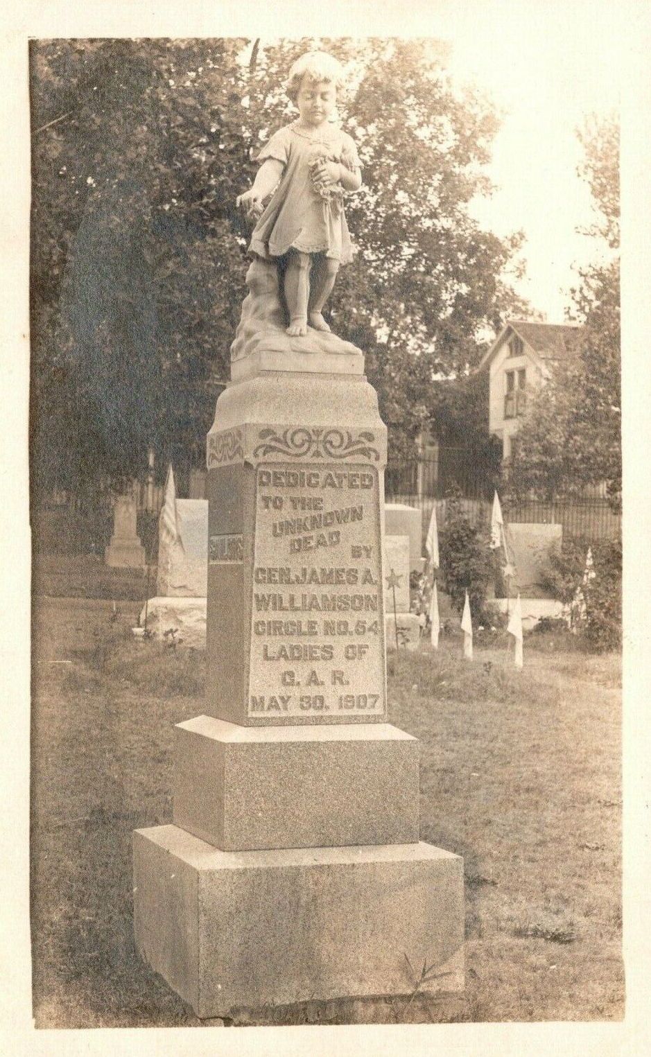
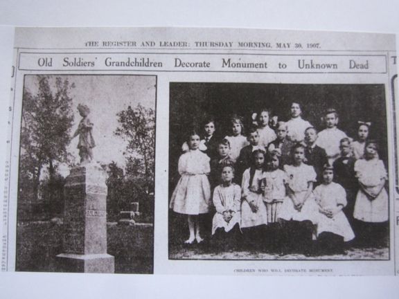
According to Woodland Cemetery historian Gerald LeBlanc, the first Decoration Day was in Des Moines in 1868. The parade was led by 12 flower girls dressed in white who went to the south GAR section at Woodland and laid flowers at the tombstones of fallen Civil War soldiers. This tradition continued, and many years later, older soldiers wanted to erect a monument that included the flower girls. This occurred on Memorial Day, 1907 with an 8 foot monument. The original name was the Monument to the Unknown Dead but is best known today as the Flower Girl Monument. The Flower Girl at the top had deteriorated and had to be replaced about 2000. This is in the east GAR section of Woodland. Photos taken 10/19/16. The second to the last image, thanks to Ron Rittel, is the newspaper article with a photo of grandchildren of CW Veterans who were to decorate the Monument. The final newspaper article provides information about the James A. Williamson Circle of the Ladies of the GAR who were responsible for the erection of this monument. Thanks to Mike Rowley for providing this article.


Des Moines - Woodland Cemetery - GAR Bench GPS Coordinates: 41.588883 by -93.646783
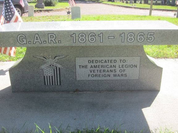
This granite bench was installed in the south GAR section of Woodland Cemetery in 2015. No formal dedication ceremony occurred. This is in the section with other CW monuments, two CW mortars, and many CW Veteran burials. The second photo shows the back side of the bench with dedication to the American Legion and Veterans of Foreign Wars. Photos taken in October 2016.

Des Moines - Woodland Cemetery - Hoyt Sherman Mausoleum GPS Coordinates: 41.590900 by -93.645900
Hoyt Sherman (1827-1904) was the younger brother of General William T. Sherman. He was a Major and served as Paymaster for the Union Army. He was a successful banker and insurance executive in Des Moines. The mausoleum is about 15 X 25 feet with a GAR marker at the entrance. It was broken in and vandalized and, as a result, the entrance was closed with blocks. The location in near the east GAR section of the cemetery. Photo taken 9/21/07.
The Sherman name remains prominent in Des Moines today. Hoyt Sherman Place is an art museum and theater. It includes the former home of Sherman. It is in a residential district called Sherman Hill located just west of downtown Des Moines.

Des Moines - Woodland Cemetery - WRC Monument GPS Coordinates: 41.590166 by -93.645266
This monument is a granite obelisk about 20 feet high. It is in Woodland Cemetery in Des Moines, Iowa. The entrance is at corner of Woodland and MLK Jr. Parkway. It is located in the GAR section on the east side of the cemetery. The first 3 photos were taken on 9/21/07. The final photo was taken at a wreath laying ceremony on Veterans Day, November 11, 2012, with members of the 49th Iowa Infantry Regiment.


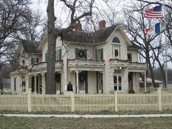
West Des Moines - Jordan House - Underground Railroad GPS Coordinates: 41.560016 by -93.734116
The Jordan House was built in 1850 by James Jordan, a cattle rancher, businessman and politician. It became a stop on the Underground Railroad. It is said that John Brown stayed there several times. The rooms are very nicely restored with period furniture, some of which is original to the house. It is operated today by the West Des Moines Historical Society - check with them for information about tours at 515 225-1286. It is located on Fuller Road just east of Grand Avenue. Photos taken 12/6/09.


Altoona and Bondurant - Polk County Freedom Rocks - GPS Coordinates: 41.702500 by -93.470000
Ray "Bubba" Sorensen has painted Freedom Rocks in each of Iowa's 99 counties. In 2022 he painted the 100th Freedom Rock as a charity fund raiser. The highest bid went to Adventureland with the Rock located at the Adventureland Inn. The first 4 photos show the four sides of this monument with Iowa Civil War General Samuel Curtis in the first photo. Go to Lee County for more information about General Curtis.
The first Polk County Rock, dedicated in 2013, is at the American Legion building in Bondurant on NE 78th Ave. The final photos show the front and back of this monument, including a painting of a Civil War soldier. The GPS is set on this location. Photos at both locations were taken 7/24/22.


