Iowa Civil War Monuments
Poweshiek County
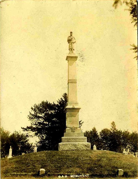
Brooklyn - Civil War Soldier Brooklyn Cemetery GPS Coordinates: 41.733966 by -92.431850
This large impressive monument is in Brooklyn Memorial Cemetery (also known as the IOOF Cemetery). It is granite and about 35 feet high. There are panels with quotations on each side. It was dedicated in 1882. The cemetery is on the east side of town. Take Des Moines Street east to the cemetery. The monument is in the SE portion of the cemetery. The first photo and the photo of the panel were taken 11/8/07. The third photo is undated and furnished by Danny Krock. The final photo was taken in front of the monument on 6/12/10 - it includes members of the Historical Society who gave tours of the cemetery and dressed up for the occasion.


Chester Township - Civil War Soldier Chester Cemetery GPS Coordinates: 41.841733 by -92.718433
This is a nicely kept up country cemetery north of Grinnell. The monument is about 13 feet high with a granite base and soldier made of marble. The face and build makes the soldier look very young. The inscription reads "In memory of our Fallen Heroes 1861-1865." Take Highway 146 north of Grinnell – turn east on 320 Avenue – then turn north on 35th street for about 1/2 mile to the cemetery. The first photo was taken 7/26/10 - the second one on 10/8/17.


Grinnell - Cannon and Plaque in Cemetery GPS Coordinates: 41.737633 by -92.736833
There is a large cannon and a nearby bronze plaque in the Hazelwood Cemetery in Grinnell. The plaque is on a small granite boulder near a flagpole. It refers to the donation of the flagpole. The cannon is a 6.4 inch Navy Parrott rifle made at the West Point Foundry in 1863. The cemetery, 120 1st Ave. W, is in the SW area of town. Take 1st Avenue west from Highway 146 to the cemetery. The cannon is located on top of a hill to the right shortly after entering the cemetery. Photos taken 10/8/17.


Montezuma - Civil War Monument and Cannons GPS Coordinates: 41.585278 by -92.523694
This red granite Civil War monument, dedicated to the memory of GAR Wisner Post #127 in 1927, has names of 188 veterans inscribed. Two 24 pounder flank howitzers, M1844, are on each side of the monument. Both howitzers were manufactured at West Point Foundry in 1858. These are located at a nice new location on the NE corner of the Courthouse Square. My photo on 8/23/19 has an unfortunate reflection so I have left a photo taken 10/26/07 at the old location which shows the inscriptions much clearer.


Montezuma - Unknown Soldier Memorial GPS Coordinates: 41.580733 by -92.530900
This monument is in the Montezuma Masonic IOOF Cemetery. The inscription on the top indicates the monument was erected by the GAR, the "S of V" and the Ladies of the GAR. Thank you to Dann Hayes for notification of this monument. The cemetery is in the SW region of town - take W. Main to High Street - then south on High Street. The monument is straight ahead just east of the maintenance shed. Photos taken 10/9/17.

Sheridan Township - Civil War Soldier Sheridan Cemetery GPS Coordinates: 41.834300 by -92.601733
This monument honors veterans of the Civil War, Spanish American War, World War and World War II. It is granite and about 14 feet high. This cemetery is in the northern part of the county – take county road T58/320 Avenue ½ mile west of Highway 63. The cemetery is across the road from the Sheridan Methodist Church. Photos taken 10/9/17.

